
Distance to Semaphore Lakes: 2.5 km. 320 m elevation gain.
Distance from Semaphore Lakes to Locomotive Mountain: 6 km. 680 m elevation gain.
If you’re looking for a scenic spot to camp with a lake nearby that is not too far from the road, Semaphore Lakes fits the bill.
Located 23.1 km up the Hurley River Forestry Service Road, this little gem is set in a peaceful basin spotted with small lakes and free from crowds.
There are a few hiking and scrambling objectives nearby- namely Locomotive Mountain and Face Mountain.
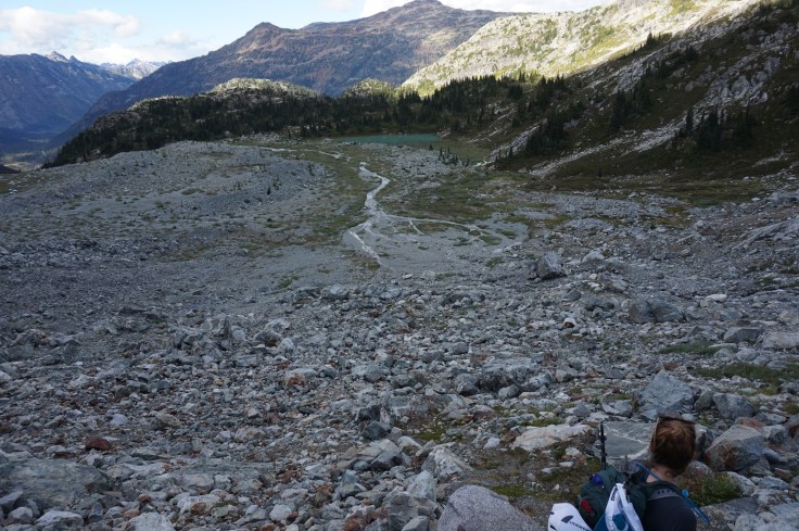
Our objective for the day was Locomotive Mountain. The trail climbs steadily from the road, following a creek for most of the way. After about 4 km of climbing, we mounted the side of the valley and were rewarded with a beautiful view of the lush basin spread before us, with mountains and the glacier framing the scene.
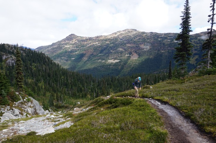
We had opted for a day-trip, but once we reached this area we wished we had brought our tent, as it looked like an ideal place to spend the night. Although there were quite a few campers up there (we spotted at least six tents), there was plenty of space to spread out and find a secluded spot.
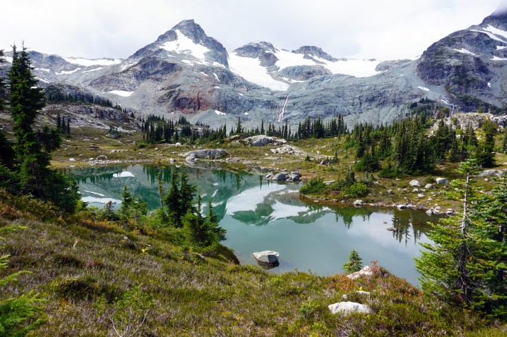
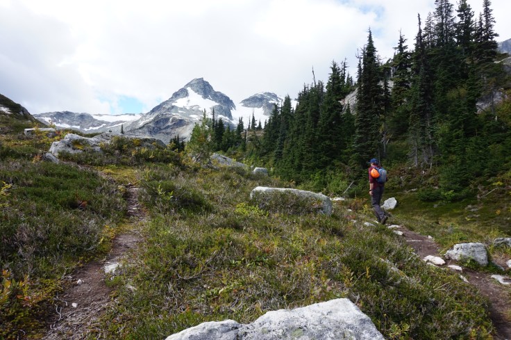
After a quick break we started on the trail towards Locomotive. Scrambling in the Coast Mountains described the route as going directly up the scree slope, but there is another trail high on the left side of the valley that is easier to follow. We saw a few other people using this route as well. So we decided to follow the crowd and take this route. When we reached the upper lake we went back to the book’s instructions and ascended the steep scree slope on the right side of the lake.
On the way back down we realized this was unnecessary and we could have followed an easier route to the left of the lake. The trail is not very well marked after this, but it is pretty clear that you must follow the ridge to the back of the mountain and ascend from there.
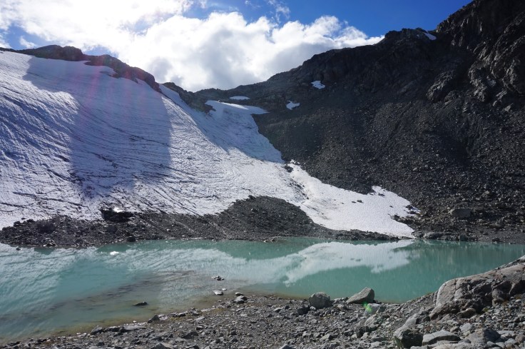
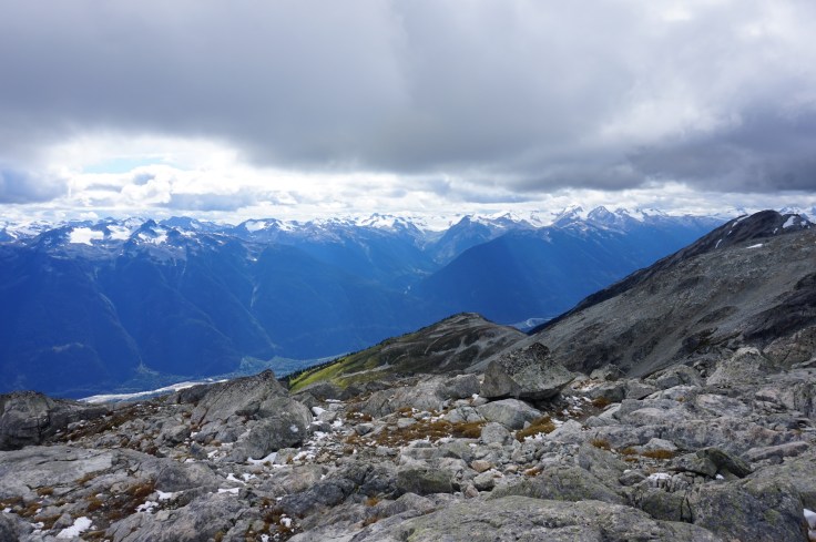
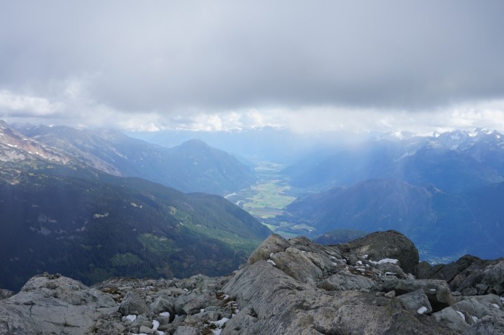
The views from the top are amazing. The Pemberton valley sweeps out before you and you have a bird’s-eye view of the Train glacier.


On the way back down it was easier to see the route and it felt a lot quicker. We descended the boulder field on the left side of the waterfall, then climbed back up through the basin to reach the main trail.

All in all, the day’s hiking took eight hours, including stops. I was well and truly ready for a nap in the car.
This is a beautiful area well worth a visit, and my tip would be to stay overnight and enjoy the beauty of the area a little longer.

Leave a comment