
Nearest town: Pemberton
Brian Waddington Hut: Distance: 10 km return (depending on parking location) | Elevation gain: 1,000 m.
Mount Gandalf. Elevation gain: 669 m from hut
Mt. Shadowfax. 595 m from hut
Special notes: The area is closed for grizzly bear foraging from August 15 – October 15 each year.
Trip completed: July 2017
Another glorious summer weekend; another hiking adventure in the Pemberton area. This time we decided to explore the Tolkien Range, located north of Pemberton and close to Birkenhead Lake Provincial Park.
With peaks named Gandalf, Shadowfax, Aragorn and Peregrine, this area immediately piqued my curiosity. What kind of landscape could have inspired the Middle Earth references? Visions of New Zealand’s stunning alpine areas around Mt. Cook came to mind, even though these mountains were named before the films were made, of course.
Matt Gunn’s ‘Scrambles in Southwest British Columbia’ suggested the difficulty level of Mount Aragorn as Easy, and Mount Gandalf as Moderate, which sounded achievable to my partner and I.
We picked up the recreation map 92/ Birkenhead Lake from Mountain Equipment Co-op and a few supplies and made a plan for the weekend. After work on Friday we drove to Pemberton and stayed the night at the Hitching Post Motel. Early Saturday we drove along the Pemberton Portage Road, continuing past the Lillooet turn off and following signs towards Birken. We turned left onto the Blackwater Road and followed this for 13.5 km. Phelix Creek FSR branches off to the right, and how far you get along this road really depends on how much you like your car. We pushed on through to within a few kilometres of the trailhead before parking, gaining our B.C. stripes (read: pinstripes) for our efforts.
Phelix Creek Approach/ Brian Waddington Hut
The trail started by crossing a log bridge over a stream and through a flat clear cut section, before entering the forest and starting to switchback up the mountain. The gradient was not too steep and we had peek-a-boo views of the valley as we ascended.


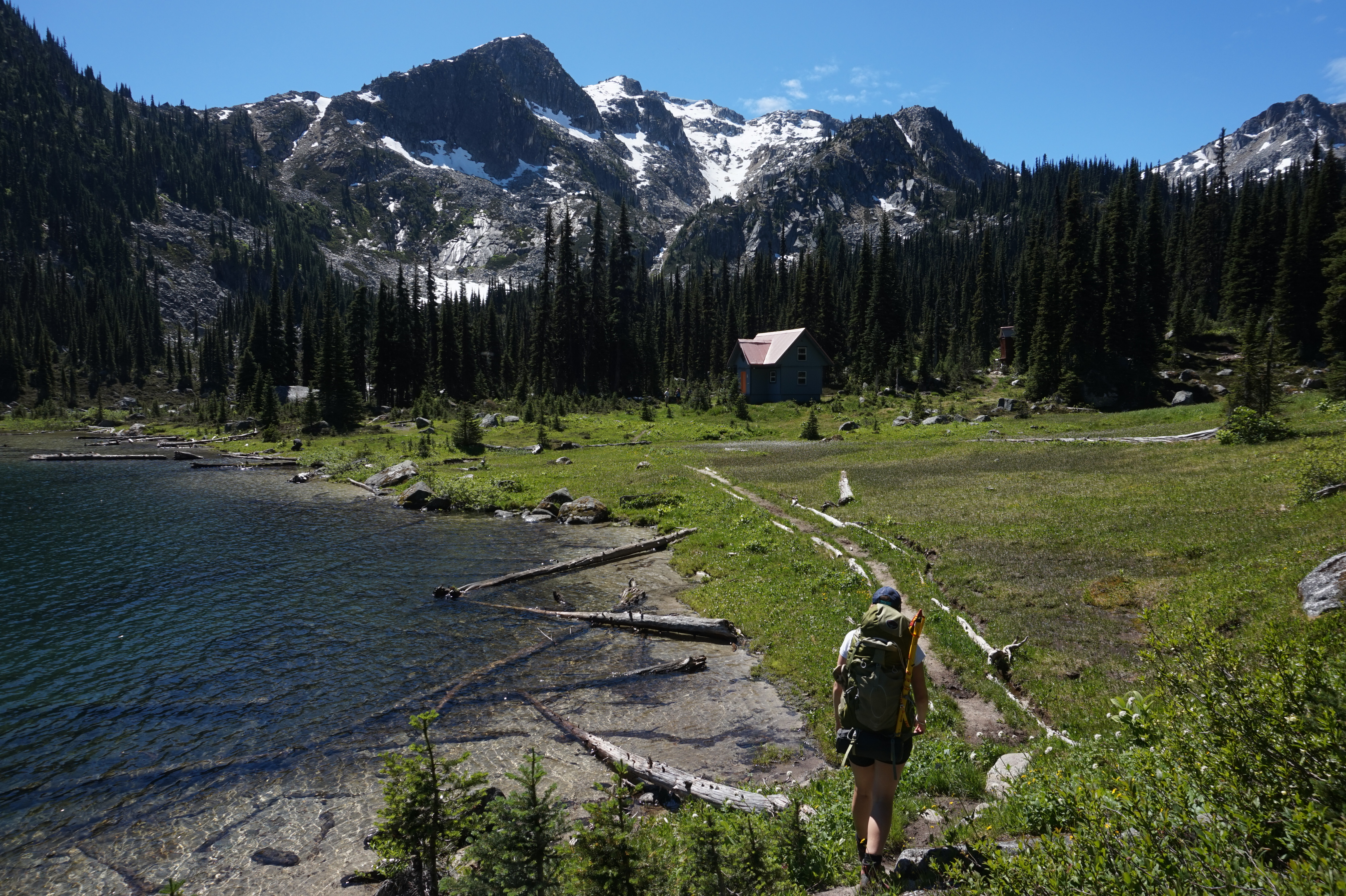
Coming up over the ridge into the upper lake basin, the views opened up and it we could see the hut nestled in the middle of the valley floor, surrounded by peaks on every side. The path skirted the lake and we stopped multiple times to capture the views.


The hut itself was basic, as most of the alpine huts are. It is owned and maintained by the Vancouver Outdoor Club, and the fee is $10 per person, per night. We found it to be clean, and not too many resident mice. There is no stove in the hut, so make sure to bring your own. Although there are spots for 24 people in the loft, we only found a group of three already at the hut when we arrived, so there was plenty of space. Starting early had paid off.

Skirting
Gandalf Mountain Scramble
Studying the map, and chatting to fellow hikers in the hut, we decided to target Gandalf Mountain, as this seemed to be the easiest of the scrambles in the area. Heading west from the hut, the trail follows a nice valley to a large lake. We hiked this section very quickly, as the bugs were vicious. A huge boulder field came into view. It wasn’t very clear which way was best to get through it, so we just started in the middle and started picking our way up the slope as best we could. The bugs were terrible, but got better as we got higher into the alpine. After the boulder field we attained a ridge, and the summit of Gandalf was visible. Routefinding became difficult as we got closer to the peak. We tried to follow the route description in the Scrambles book, but we soon found ourselves in a steep section of granite that was fast becoming more of a rock climbing route than a scramble. We backtracked down the slope a bit and finally saw a safer route to the right. Popping up onto the spine we could see the large crooked boulder that looked like a wizard’s hat, hence the name Gandalf Mountain. It was getting late, so we decided not to continue along the ridge to Mount Aragorn. Apparently it’s possibly to drop down into the basin from the col between Aragorn and Gandalf, but looking at the steep route of loose rock from the summit of Mt. Gandalf, there was no way we were going to attempt that. We decided to go back the way we had come, even if it meant another crack at the challenging boulder field and aggressive bugs .

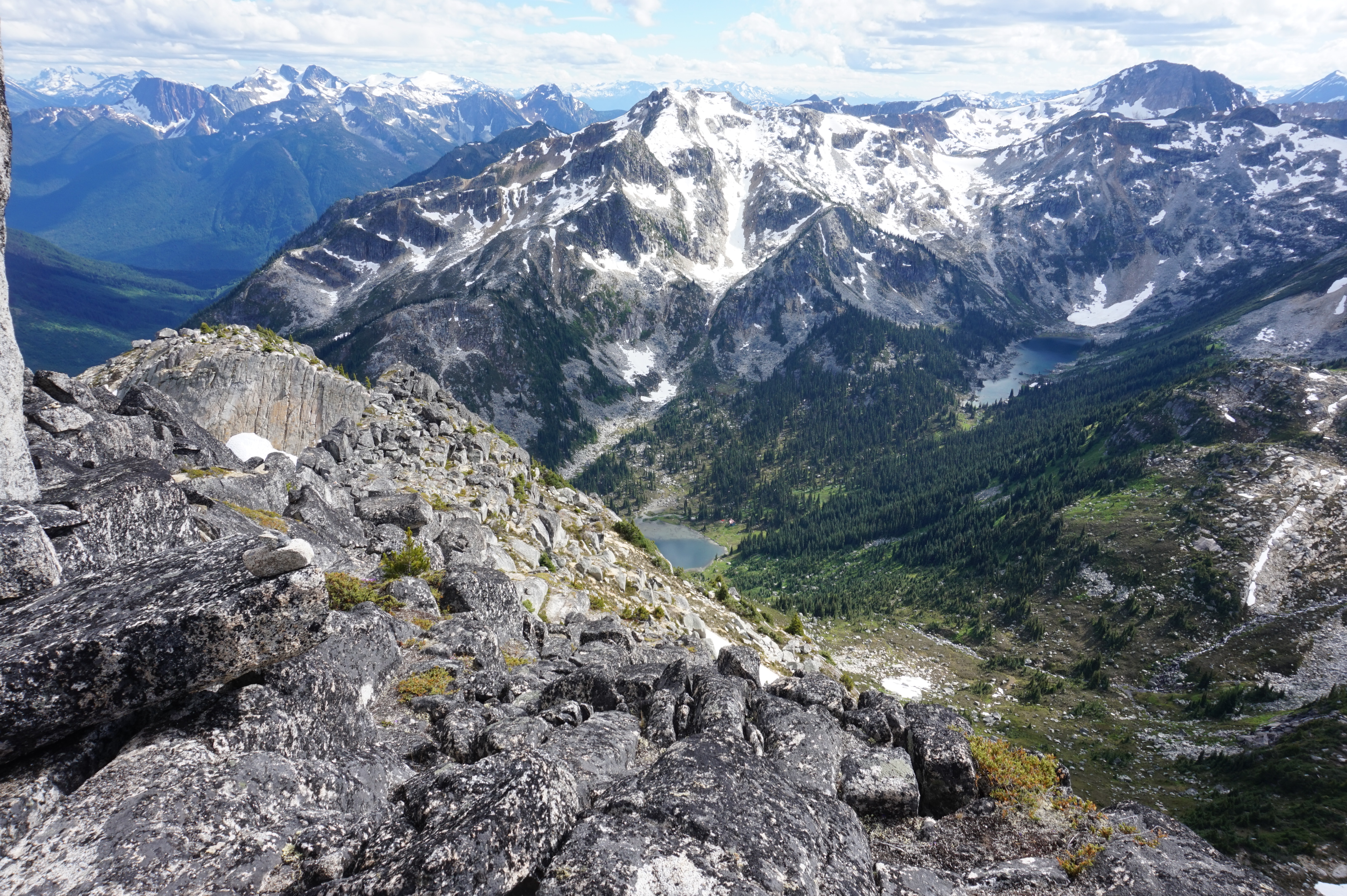

View from Gandalf Mountain.
Mount Shadowfax Scramble


The next morning we decided to try for Shadowfax Peak before packing up and heading out. Routefinding was again a challenge – the path that ascended directly up from the lake to the basin between Gandalf and Shadowfax was very overgrown and we lost it in a few places, opting to just push our way through the growth. Once we reached the basin, the trail was a lot easier. Shadowfax was a fun scramble and a fair bit shorter, with stunning views. We enjoyed it a lot more than Gandalf.
Again, we opted to go back down the way we’d come up. Donning our large backpacks, we walked back down to the car, and were grateful we had driven the Jeep so far up the forestry road, as it cut off a few kilometres of hiking, right when we were tired and ready to call it a day.


Leave a comment